- 15 October 2024
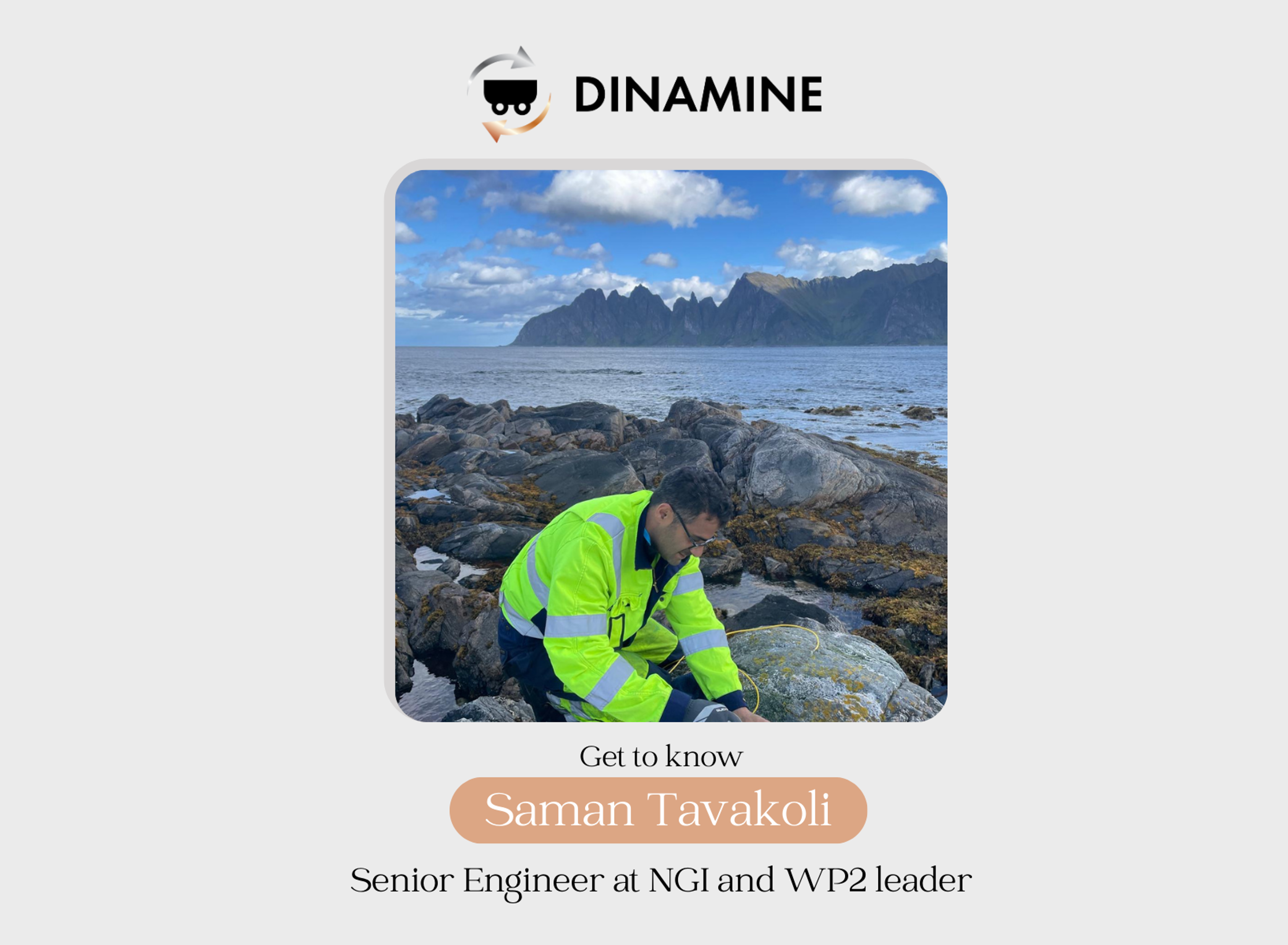
MEET THE DINAMINE PARTNERS! Get to know Saman Tavakoli, Senior Engineer at NGI and WP2 leader
Saman Tavakoli, Senior Engineer at NGI and WP2 leader, brings a wealth of expertise in geophysics and sustainable mining.
With a passion for mineral exploration, Saman leads the Exploration and Geomodelling work package, applying advanced 3D ore-deposit modeling and geophysical exploration to optimize mining processes and reduce Europe’s dependence on imported raw materials.
His team is working on innovative solutions to explore deeper deposits using machine learning, drones, and geophysical sensors. With promising results from sites in Norway and Portugal, the future of sustainable mine exploration is bright.
Discover more by reading his interview!
*
Tell us about yourself
I was born in Iran and spent almost half of my life there. Having lived in a country with rich natural resources, I soon became find exploration of natural resources very interesting. After completing my BSc education in Iran in Mineral exploration Geophysics, I was accepted as trainee at exploration department in Iranian Oil and Gas company and I found it fascinating to work with real-world exploration activities! Following that, I decided to pursue my educations in Europe and started my Joint MSc educations in Geophysics in Sweden and Germany. I then started my PhD education in exploration Geophysics at Luleå University focusing on mineral explorations and in particular exploration of Volcanic Hosted Massive Sulphide (VHMS) deposits. I had the chance to work with that time’s member of the Nobel Prize committee in Physics, professor Elming and I feel very honored for that. I got the chance to learn about almost every existing geophysical method which is applicable in mineral exploration industry e.g. DCIP (Direct Current Resistivity and Induced Polarization), magnetometry, gravimetry, EM (Electromagnetic), SP (Self-Potential) and MRS. This is a long list to I need to stop here 😊 Between 2013-2014 I did a postdoctoral position in Norway which helped me to expand my network further across Nordics. From 2014 to 2020 I worked as senior lecturer at Luleå University of Technology as project manager for several research projects and also involved with course development in exploration geophysics. That was also where I first got involved in Horizon projects. My interest towards environmental Geophysics took me to Russia, Saint Petersburg State University (SPBU) to work with SP application in studying environmental aspects of the mining activities and mine tailing characterizations, which I found very interesting. In 2020 I joined NGI and since then I am involved in diverse types of projects, from environmental geophysics to geotechnical geophysics, arctic research and to my main interest i.e. mineral exploration geophysics. I currently lead the Exploration and geomodelling work package in Dinamine project (WP2) and I am also technical Coordinator for MINEYE (another Horizon Europe project started 2024).
What inspires you about working in the DINAMINE project? Tell us about your role as a Work Package leader
“Contribute to provide greener and more access to critical raw materials for a more sustainable world”. Of course, using cutting-edge technologies and also in collaborations with other project partners. Europe is particularly vulnerable in provision of the CRM which is crucial to meet its green transition. We in Europe currently import more than 75% of the raw material required to achieve sustainability goals. The Eu estimated that we will require 18 times more lithium and five times more cobalt in 2030 compared to 2020. Therefore, clean energy technologies require access to larger amounts of raw materials, such as copper, lithium, nickel, aluminum and rare earth elements (REE), compared to fossil fuel-based technologies. As a result, we need faster and cleaner growth for mineral industry, in Europe but also globally. What we sometimes forget about is that although these technologies are developed during projects such as Dinamine and aimed for Eu applications, they can be utilized in other parts of the world (depending on the type of deposits, accessibility etc). As a WP leader for Exploration and Geomodelling, I am responsible to plan and implement geophysical surveys i.e. collect and provide data required for (i) implementation of the Dinamine project, and (ii) mining companies to expand their minable reserves and thereby production. The collected data, however, first needs to be processed and modelled before they can be used for interpretation. In parallel, I also need to keep constant dialogue with the mining companies in the project to ensure that our activities are fully in line with their requirements. I feel lucky that our mining company partners are great in collaborations which made the work even more interesting. Moreover, I need to ensure that the implementation of other tasks within our WP, and our WP with other WPs is conducted according to the plan. Keeping an eye on timeline, budget and dissemination activities in our work package is another aspect of my role as work package leader.
Can you walk us through the work already completed and planned in your Work Package?
Our approach was well-planned and implemented according to the plans.
We have three tasks in our Work package, o which T2.1 is completed and delivered, and the two other are under development:
- T2.1. Developing a real-time updatable geomodelling algorithm
- T2.2. Geophysical exploration and 3D ore-deposit modeling
- T2.3. Mine Information Model or MIM
For exploration (T2.2) we studied almost every other project who aimed to explore similar types of deposits and tried to taylor that for our specific deposits at each site (investigation depth, thickness of the layers, background geological characteristics etc.). Then, in dialogue with our Demo sites we conducted the following exploration approach which is based multidisciplinary methods and is multi-scale: Regional Scale (Large-scale) Exploration –> Local-scale (Near-mine) –> Deposit Scale (small-scale).
Norway (graphite deposits) – we processed large-scale magnetic and gravity anomalies to understand the regional-scale shear-zones and faults which can control the structure of the mineralizations. We then conducted a series of EM surveys to better understand the presence of the graphite layers near-mine and inside the mine tunnels. We also characterized petrophysical properties of the core samples by taking them to the lab and measuring e.g. electrical resistivity, magnetic susceptibility and other properties. This information is later used when we model results. We then processed these data and created 3D models of the deposits or constrain the existing models. These data will also be used later to feed our Mining Information Model (MIM).
Portugal (Pegmatite deposits) – Similar to the case for Norway, we first had a dialogue with the mine geologists to decide on priority areas for exploration. We then used a subcontracting EM company for fast and large-scale scanning of these areas. Based on the results and after further discussion with geologists, we then decided to conduct some DCIP (ERT) measurements with our specific set-up and the results were very promising. We are now in the process of discussing making complementary measurements using additional geophysical methods to map the pegmatites in deposit-scale. Petrophysical data, data processing and modelling will be conducted in same manner as was explained for Norwegian site.
The choice of methods, their survey characteristics, combined implementation, place of survey etc. all depend on a series of parameters such as deposit type, depth of occurrence and expected petrophysical properties of the target ore and its background rocks.
How do you envision the future of mine exploration methods in Europe?
Bright but challenging. The prevalence of drones equipped with geophysical sensors, developments in use of ML based data fusion techniques, and technologies that enable us to explore and extract deeper deposits all can contribute to a brighter future for explorations in Europe. Environmental issues and concerns around incorrect use of Machine Learning methods are some of the main challenges which I can think of.
What outcomes are you aiming for with DINAMINE?
In work package level, our interactive exploration approach ranging from regional to deposit scale using diverse set of geophysical tools for each step is unique and we hope to be utilized as a successful example for exploration of similar types of deposits. From a larger perspective, I hope that the outcomes of WP2 and its interaction with MIM Technology and the Integrated Smart Mine Planning and Managing Platform (ISM-PM), which is the heart of Dinamine project, all make this project a successful example from good investment by EU to benefit Europe’s resilience within raw material and mining industry.